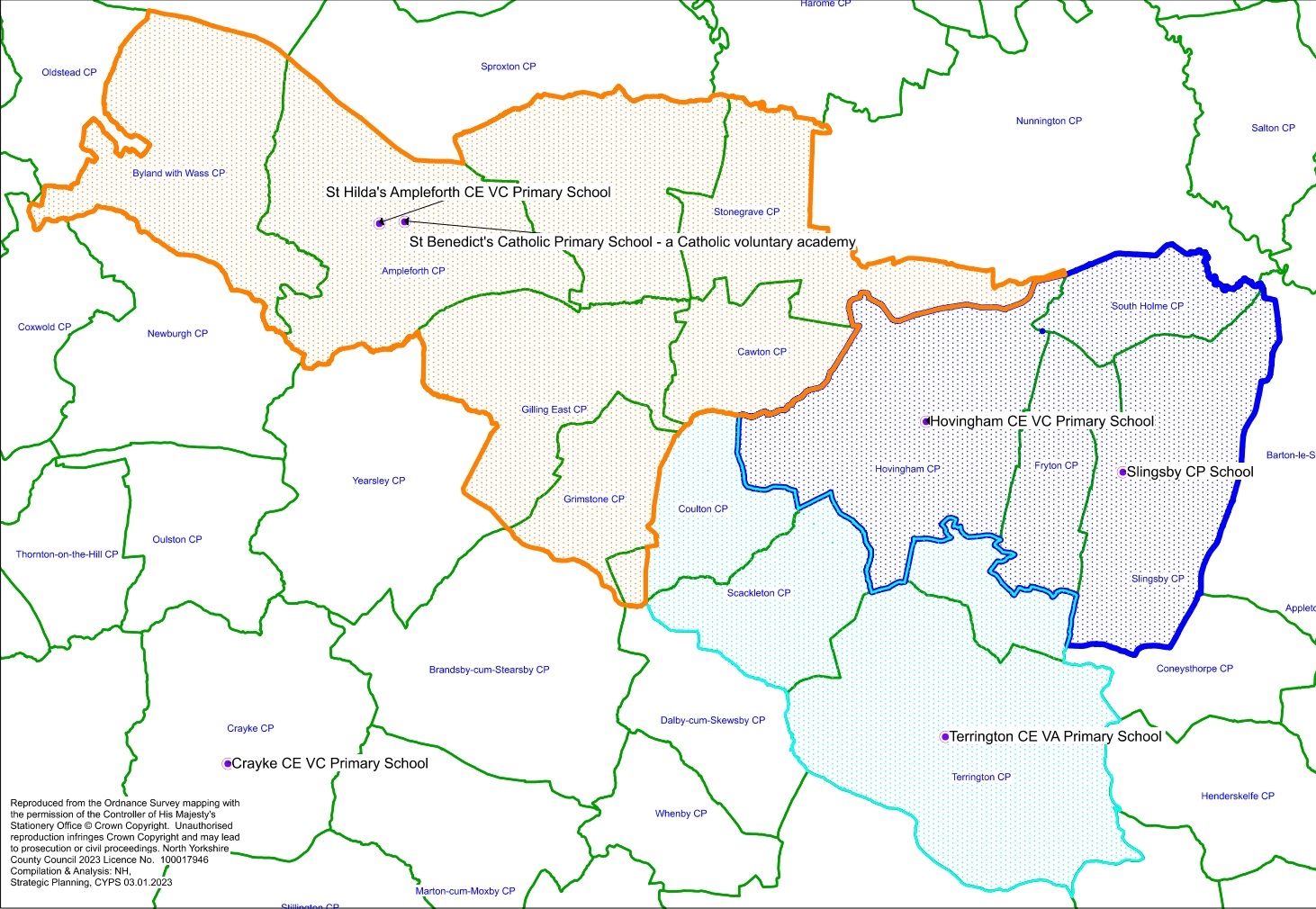
North Yorkshire Council

Breadcrumbs

  1. Home
  2. Map of Catchment Areas proposed as part of the statutory proposals to close Hovingham CE Primary School

Map of Catchment Areas proposed as part of the statutory proposals to close Hovingham CE Primary School

Image
Map of the current catchment area as well as the proposed new one

Map key

  • Orange: Catchment area for St Hilda’s Ampleforth CE VC Primary School
  • Light Blue: Catchment area for Terrington CE VA Primary School
  • Dark Blue: Catchment area for Slingsby Community Primary School

 Rate this page

How would you rate this page?

A to Z of council services

A | B | C | D | E | F | G | H | I | J | K | L | M | N | O | P | Q | R | S | T | U | V | W | X | Y | Z

Extra links

  • Get in touch
  • Accessibility
  • Privacy
  • Cookies
  • Terms and conditions
  • GOV.UK

Social media

  • Facebook
  • Twitter
  • Instagram
  • LinkedIn
  • YouTube
  • More social channels

© 2026 North Yorkshire Council

The council provides services across North Yorkshire including Harrogate, Ripon, Scarborough, Whitby, Northallerton, Thirsk, Selby, Tadcaster, Malton, Pickering, Richmond, Skipton and more.

Digital Assistant
BETA

This is a new service – your feedback will help us to improve it.